Geological Fluid Dynamics
Department of Geology
University of Illinois at Urbana-Champaign
Department of Geology
University of Illinois at Urbana-Champaign
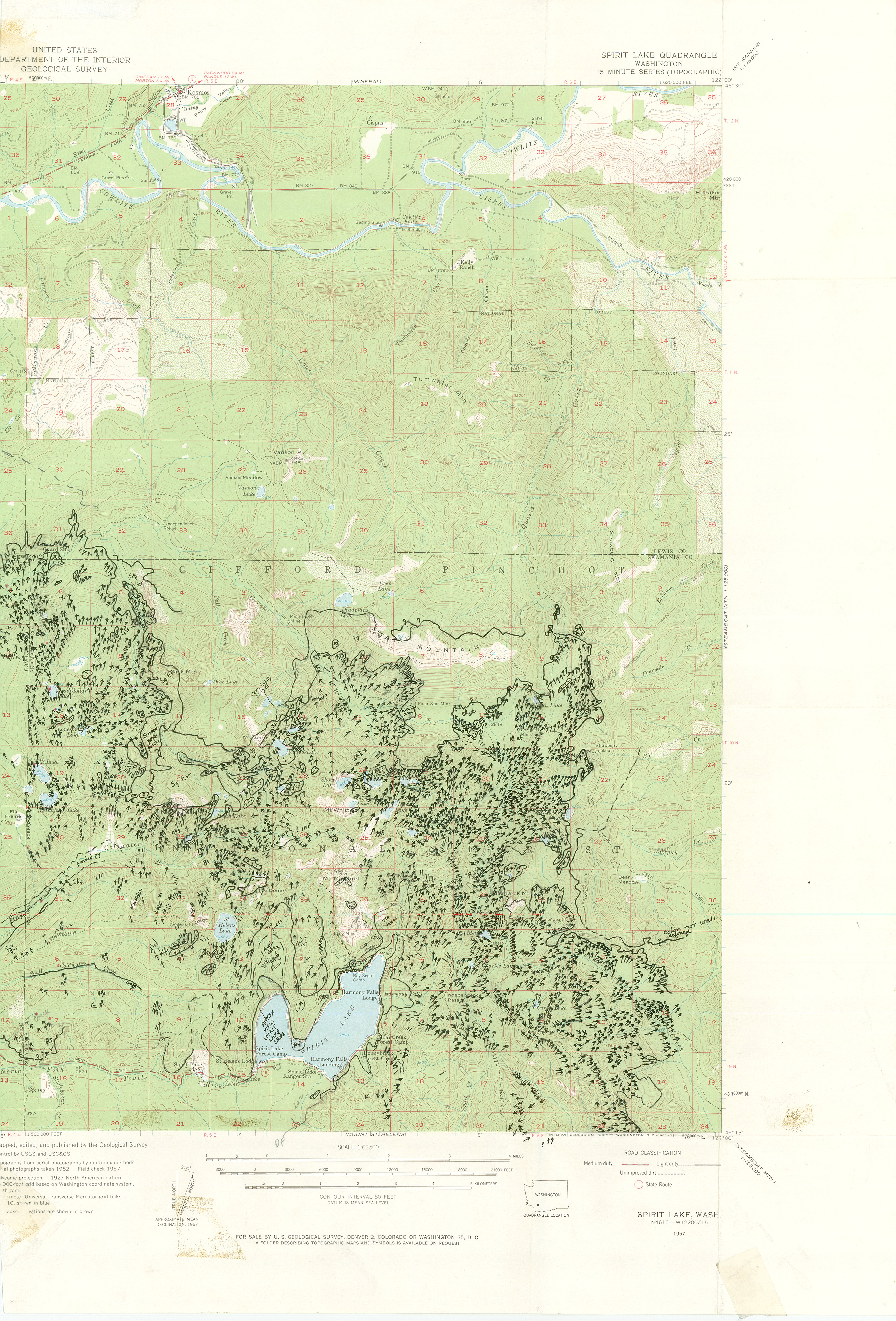
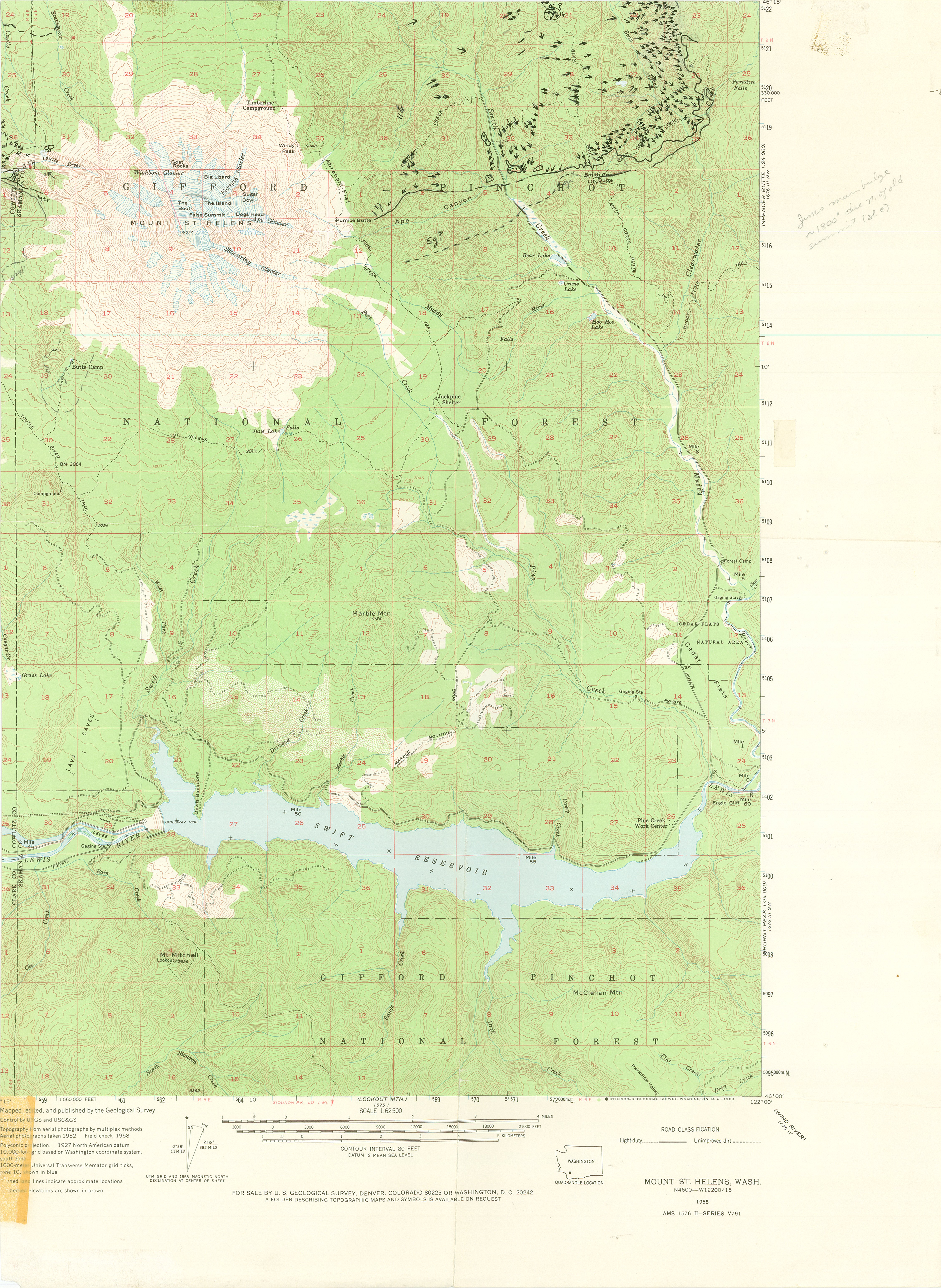
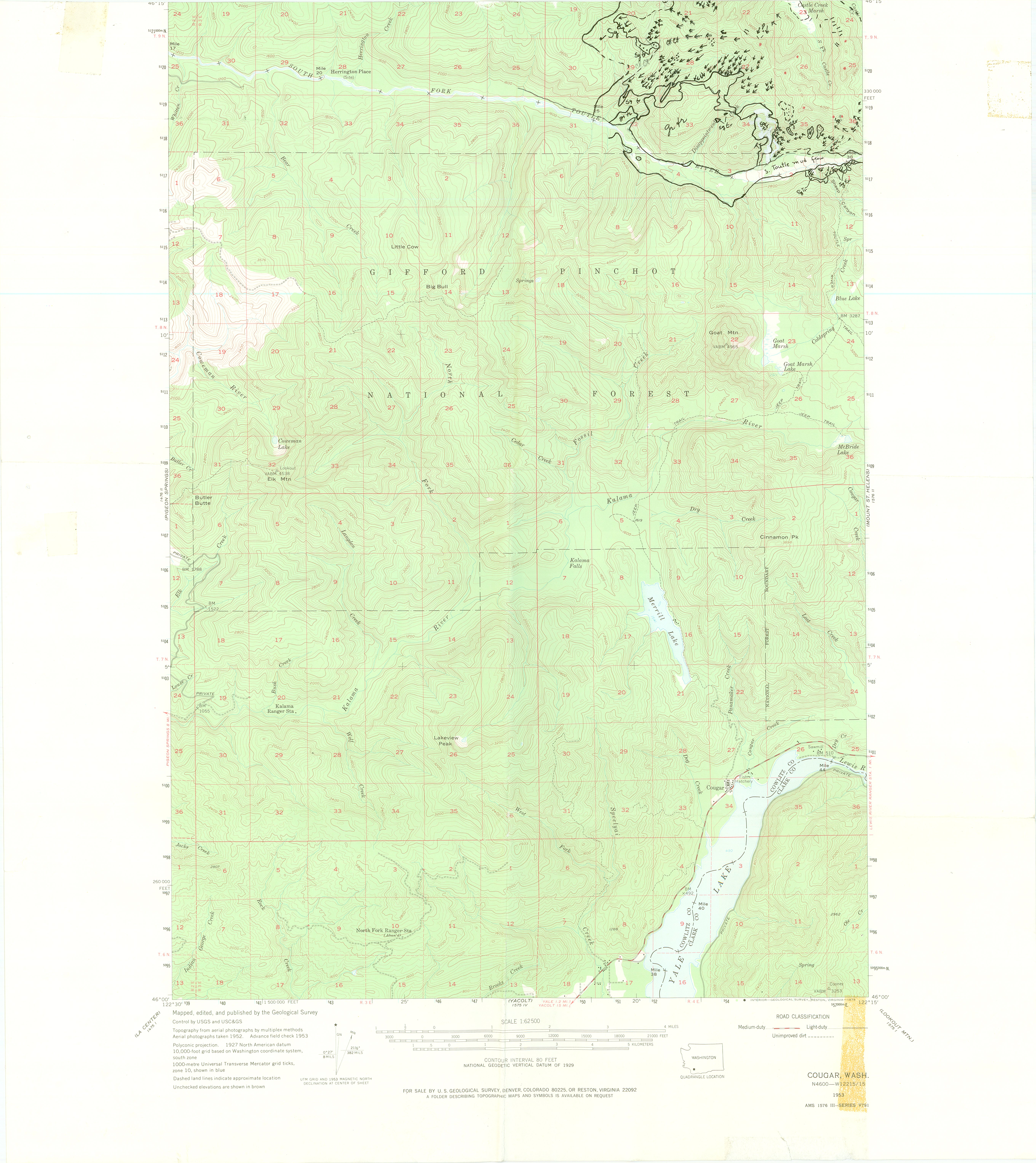
Annotated Maps of Tree Trunk Orientation following the 1980 Mount St. Helens Blast

If you use these maps, please cite as follows:
"Susan W. Kieffer, prepared 1980 from air photos ot the tree blowdown pattern, http://www.geology.uiuc.edu/~skieffer/maps.html"
"Susan W. Kieffer, prepared 1980 from air photos ot the tree blowdown pattern, http://www.geology.uiuc.edu/~skieffer/maps.html"